
Still Image
Ski Trails of the Harlow Ski Club (1946 trail map)
- Title
- Ski Trails of the Harlow Ski Club (1946 trail map)
- Description
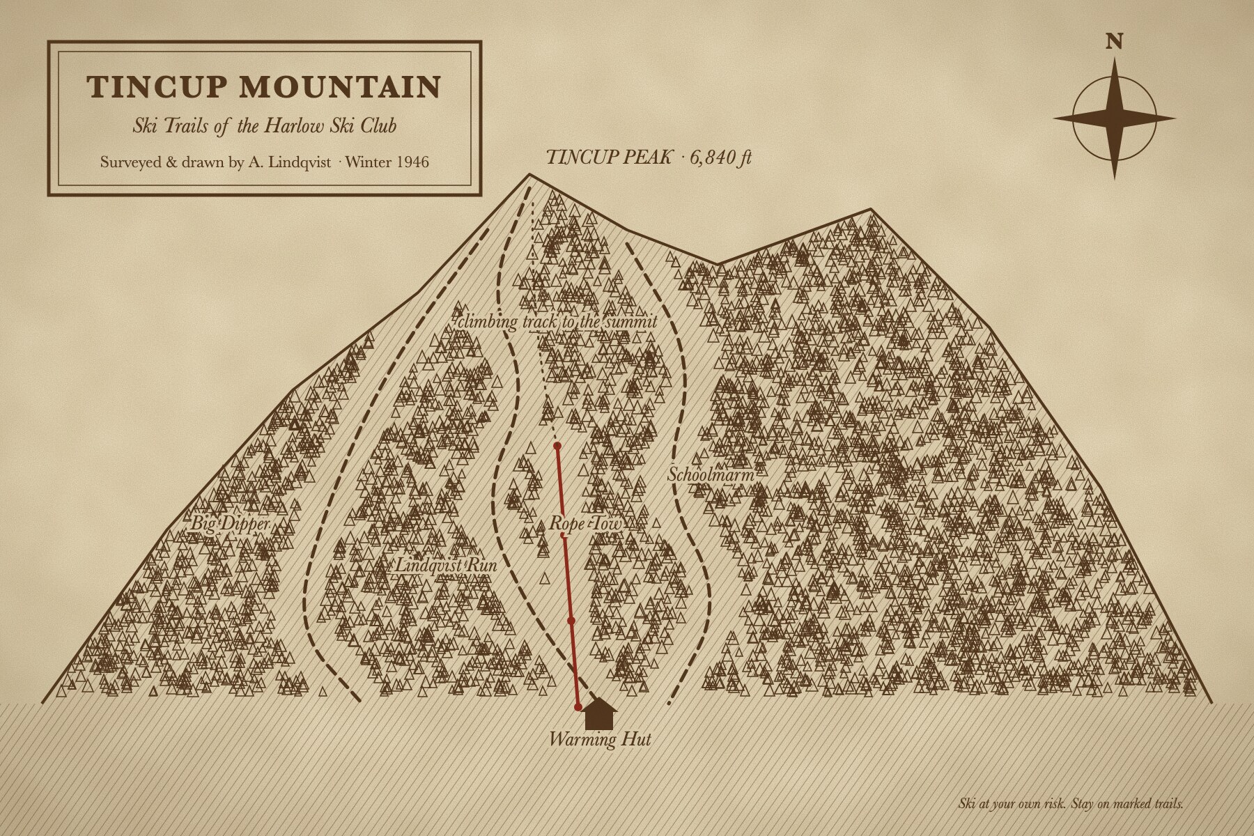
- Hand-drawn map of the three trails of 1946 (Lindqvist Run, Big Dipper and Schoolmarm), the rope tow and the climbing track to the summit. Arne Lindqvist surveyed and drew it, and the club sold copies at the warming hut for a nickel.
- Creator
-
 Arne Lindqvist
- Date
- 1946
- Identifier
- TINCUP.1946.01
- Publisher
- Harlow Ski Club
- Rights
- Fictional demonstration content created for the Omeka S demo. Free to reuse (CC0 1.0).
- Subject
- Trail maps
- Skiing
- Rope tows
- Type
- Map
- Original Format
- Ink on paper, reproduced by blueprint
- Physical Dimensions
- 45 × 30 cm
- Spatial Coverage
- Tincup Mountain, Harlow, Idaho (fictional)
Linked resources
- Site pages
- The Rope Tow Years, 1938–1951